When renovating or expanding an existing structure, documentation is often extremely out of date or simply does not exist. This makes designing any type of renovation or addition difficult. Being able to accurately capture existing conditions and easily feed that information into the design model is imperative to keeping projects on time and on budget.
For large projects and complex structures, reality capture solutions, such as laser scanning (also called high-definition surveying, or HDS), scanning total stations (also called multistations) and backpack mapping systems, are increasingly used to capture complete detail of the entire space in 3-D.
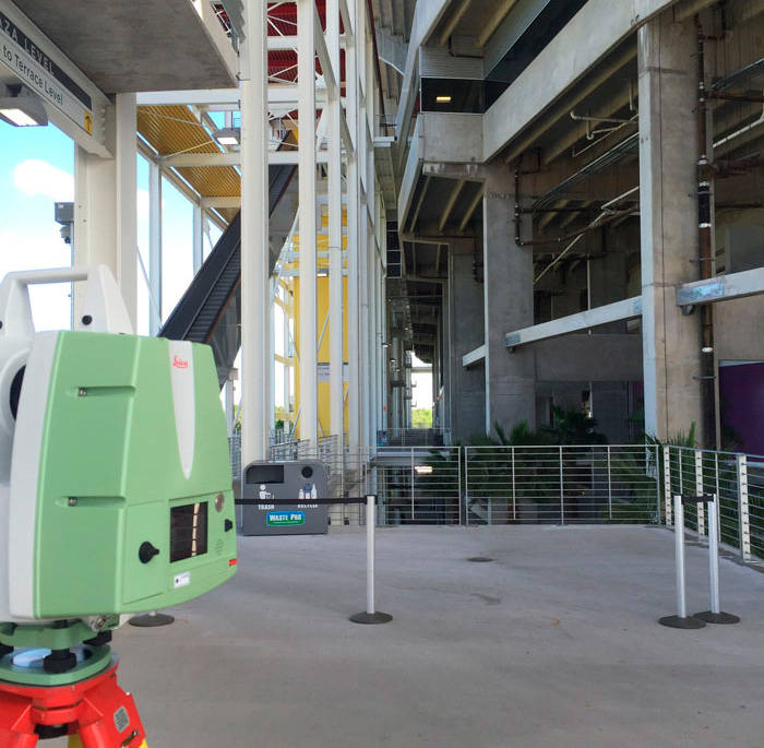
 Image 1. Reality capture solutions, such as laser scanning, capture the complete detail of a space as a point cloud
to provide extremely accurate existing conditions documentation.
This is much like a camera taking a 360-degree photo, but with an accurate x,y,z position for every pixel. This detailed representation of the scene is called a point cloud. This data is then brought into CAD or BIM software and used to develop extremely accurate existing conditions documentation in the form of either 2-D drawings or 3-D models.
The point cloud data from a high-quality reality capture solution is so complete that it provides the project team with details all the way down to the bolt patterns on steel pipe fittings. Software packages have built-in libraries where actual sizes of steel and/or pipes can be identified and modeled directly from the point cloud.
As construction progresses, point clouds can be used to compare the newly constructed work against the as-designed model or drawings for quality assurance. If reality capture or progressive scanning is used throughout the entire construction project, the new facility will have as-built documentation from all major milestones, providing future virtual access to what is behind walls, above ceilings and under the floors.
The ability of reality capture to enable comparisons with as-designed models and drawings, provide archival records and document-critical milestones provides tremendous value throughout the construction process and beyond as the building is managed, maintained and renovated.
Managing Point Cloud Data at the Source
Whether you purchase point clouds from a service provider or self-perform reality capture, the software used to process and manage the point cloud can make all the difference in maximizing the value of your investment. Even if you choose to outsource reality capture services, you can still manage your own point clouds with a minimal investment in software. In fact, using the software as the foundational component of reality capture can give you the maximum amount of flexibility in applying reality capture to your projects. Many construction firms have successfully moved into laser scanning and other reality capture methods by starting with software.
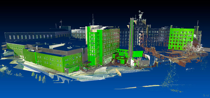
 Image 2. Whether you purchase point clouds from a service provider or self-perform reality capture, the software used to process and manage the point cloud can make all the difference in maximizing the value of your investment.
If your firm self-performs reality capture or works with raw point cloud data, you will need a powerful software package. The software should integrate seamlessly with your reality capture hardware, regardless of the manufacturer or model, and should allow you to easily view and measure from the point cloud, as well as export standard industry file types.
Combining multiple scans together—a process known as registration—should be fast and easy and should allow you to create an accurate site representation through a variety of different methods.
Your software should also enable you to orient the point clouds to match your CAD or BIM project, view and reference the point clouds, compare them to models, generate clash reports, perform automated model-to-point-cloud deviation detection, do quick visual checks or floor flatness/floor levelness checks on concrete slabs, document the final-as-built and add tags with operations and maintenance information.
If you work with a service provider and purchase point clouds that are already registered and oriented, your point cloud software needs will be less robust. However, you can get more value from your investment by using software that allows you to easily view and reference the point clouds, and compare them to models and generate clash reports.
Quick visual checks and floor flatness and floor levelness checks on concrete slabs, documentation of the final-as-built, and the ability to add tags with operations and maintenance information should be standard capabilities available in your software package.
Whether you self-perform or outsource your reality capture work, be sure to evaluate your point cloud software on the following parameters:
- Data extraction—The software should provide tools that make it easy to view and work with the data.
- Modeling—The software should provide extensive shape libraries, as well as clash detection and anti-clash capabilities.
- Viewing—The software should enable point cloud data to be shared easily with clients.
- Importing—The software should allow you to work with data from multiple scanner makes and models.
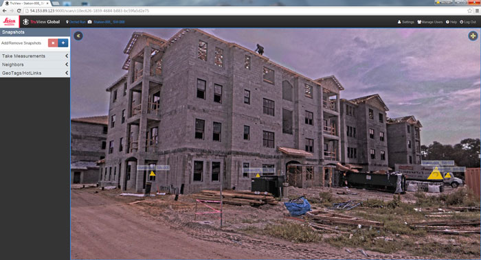
 Image 3. The software you use to manage your point clouds should provide an easy way for you to share the data with clients and other stakeholders.
Using Point Clouds in CAD Packages
Because of the tremendous amount of information in point clouds, many major CAD packages have been updated to deal with these datasets on some level. However, achieving the most efficient management and review process requires additional software that can seamlessly plug in to the existing CAD environment.
When evaluating point cloud software, keep in mind that modern reality capture solutions collect enormous amounts of data in very short periods of time. In many cases, a single laser scan position might contain 30 to 60 million scan points, or even 150 million points or more, depending on the application.
The scan area can also vary from a single location to hundreds. When this volume of data is introduced to an already graphics-heavy CAD environment, the potential to bog down computer system performance is very high. A software solution that can handle billions of points is important when choosing a plugin.
Another consideration is managing the point cloud once it is in the CAD environment. Since reality capture solutions rely on line of sight, they will generate points on everything they can “see.”
The software must have a strong set of point cloud management tools so that work areas can be easily isolated for proper data extraction. For example, in a large, multilevel building scan, each floor and each room may need to be isolated. A software system that can retain clips or limited viewing areas is imperative.
Finally, it can be easy for new users of point clouds to get “lost” in the data. In a CAD environment, the scanned surfaces are transparent; other scan points are visible through the surface that is the focus of the data extraction effort. It is all too common to inadvertently pick points behind or in front of the intended surface. To avoid these errors, the software should provide a “bubble view,” point cloud filters, or a combination of these tools.
Better Buildings through Better Information
Capturing reality in the form of highly accurate point clouds before and during the construction process is the fastest and most accurate way to document the complete jobsite so that work can be evaluated on a weekly or even daily basis to assure the best quality construction. The rich detail provided by point clouds, combined with the easy-to-use, powerful tools in modern point cloud software, allows you to see and truly understand the real-world conditions compared to design intent.
The result is a lifecycle process that brings reality into the digital models and the models into reality for a holistic building construction approach that empowers you to reduce rework and achieve new levels of efficiency and profitability.
